Maps
Maps (from the Home screen, or from the command with the stacked sheets in the survey column) chooses what you see under the points: a basemap, some layers over the basemap and the offline maps to work without network.
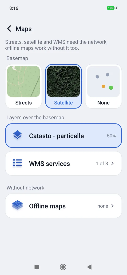
Streets, satellite and WMS need the network; offline maps work without it too. The source of the background map appears at the bottom left of the map («© OpenStreetMap» or «Esri, Maxar, Earthstar Geographics»); tapping the OpenStreetMap one opens its copyright page.
The basemap
You tap the preview:
| Basemap | What it is |
|---|---|
| Streets | The OpenStreetMap map: roads, trails, place names. |
| Satellite | Aerial and satellite photos (Esri and partners): in the woods you recognise clearings, tracks and crowns. |
| None | A neutral background, only the points. Useful to see the points well or when the network is poor. |
| An offline map | It appears in the list when you add one (see below). |
geosit remembers the chosen map.
The layers over the basemap: WMS services
A WMS service is a map published on the Internet by an agency (cadastre, orthophotos, forest maps, zoning plans…) that geosit draws over the basemap, transparently. At first the list is empty: you choose the services, adding them one by one or importing a list from a file.
In Maps, under Layers over the basemap, the ones turned on appear (up to two, with their coverage); tapping one you choose how much it covers the basemap (25, 50, 75 or 100%) or you turn it off. WMS services opens the full list.
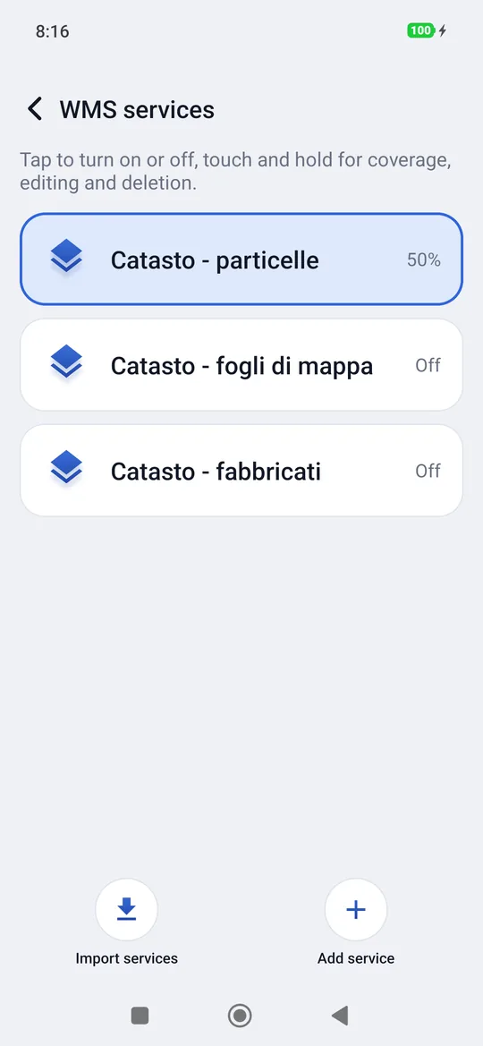
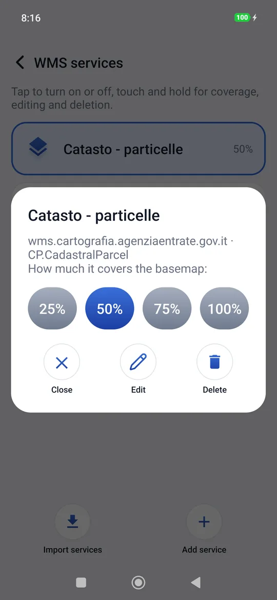
In the WMS services list:
- a tap turns a service on or off;
- a long press chooses the coverage; Edit changes the address, layers and name of the service, Delete removes it. This applies to all services, including the Cadastre and Orthophoto left over from previous versions.
Importing a list of services
A list of services can be kept in a .json file and loaded in one go, for example to give
the same services to a whole team.
- Download the ready list to the phone: servizi-wms.json (the Cadastre of the Agenzia delle Entrate: parcels, map sheets and buildings).
- Maps → WMS services → Import services and choose the file.
- geosit adds the services it does not already have, turned off; tap one to turn it on.
The file is a list of services, each with nome (name), sorgente (the address), strati
(layers), crs (the system of the requests, for example EPSG:3857 or EPSG:4258) and
alfa (the coverage, from 0 to 255). It can be written by hand or copied from the guide's and
edited.
Adding a WMS service
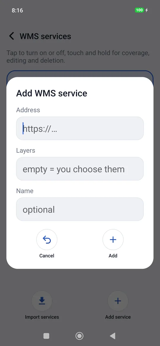
- Maps → WMS services → Add service.
- Write the address of the service (the one the agency publishes, which starts with
https://;http://works too). - Layers: leave it empty and geosit asks the service for the list of layers and lets you choose them; or write the name of the layer yourself.
- Name (optional): how it will appear in the list.
- Tap Add: geosit checks the service (Checking the service…).
If the service does not respond
With a wrong address or without network geosit says Service unreachable. If you wrote the layers by hand, the service is added anyway (Service not verified): if it then stays empty, delete it and add it again with the network.
Offline maps
In the woods there is often no network. An offline map is an .mbtiles file with the images
of an area already prepared (for example an orthophoto or a technical map of your own area,
prepared in the office with a GIS program): once on the phone it works without network.
To add it:
- copy the
.mbtilesfile to the phone (USB cable, Drive, a USB stick…); - Maps → Offline maps (under Without network) → Add map and choose
the file (you can also do it from Project → press and hold the project → Import: an
.mbtilesfile is recognised automatically).
geosit copies the map into the app (Copying the map …; a province can weigh hundreds of MB, it takes a while) and sets it as basemap straight away: Offline map ready.
As for WMS services, in Maps there is a single row, Offline maps, with how many there are on the phone; above it, the one in use, with the file name. The row opens the list: there you see how much each one weighs, a tap uses it as basemap, a long press deletes it, and at the bottom there is Add map. At the top, the arrow ‹ Maps takes you back.
Before leaving
Prepare the offline maps and check that they show before going up into the woods, with the office network. In the field the receiver and the battery will be enough.