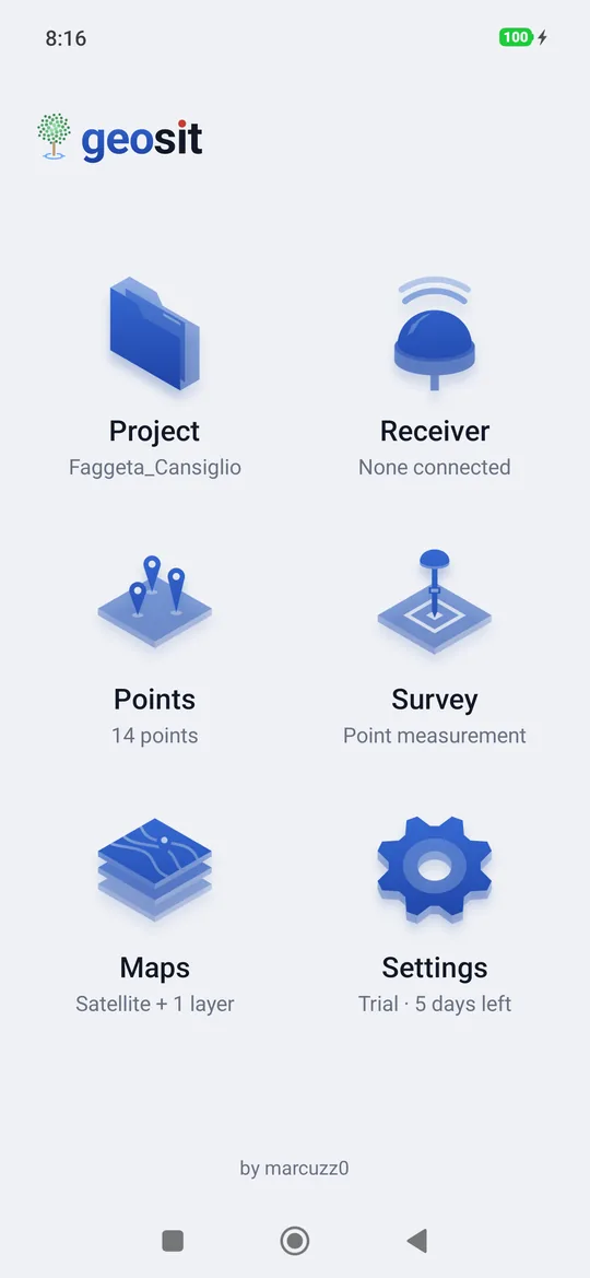
The Home screen
The Home screen is the starting point: six big buttons, each with a line underneath that tells the current status. From every screen you come back here with the arrow at the top with the screen's name (for example ‹ Projects) or with the phone's back button.
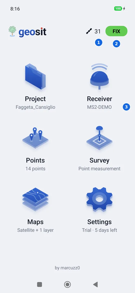
- Satellites used by the receiver to compute the position.
- The solution: FIX, FLOAT, DGPS, Single or NO (see below). Tapping the satellites or the solution opens the status panel.
- Under each button, the status: here the name of the connected receiver.
Satellites and solution appear only with a receiver connected: without one, only the logo stays at the top. The receiver's charge is not here: it is in the survey bar and in the status panel.
The six buttons
| Button | What it opens | The line underneath says |
|---|---|---|
| Project | The list of projects, with Import and Export | The open project, or None open |
| Receiver | Searching for and connecting the receiver | The connected receiver, Connecting…, Reconnecting… or None connected |
| Points | The list of points of the open project | How many points the project has |
| Survey | The map for measuring (and for static, kinematic and Stop & Go) | The chosen mode: Point measurement, Static, Kinematic or Stop & Go |
| Maps | The choice of basemap and layers | The basemap in use and how many WMS services are on, for example Satellite + 1 layer |
| Settings | License and preferences | The license status: Demo mode, Trial · 4 days left, No license or, with the license, License, options |
At the bottom, in the centre, there is by marcuzz0: a tap opens an email to write to us. The app version is in Settings.
A project first
Survey and Points always work on the open project. If there isn't one, geosit writes First open or create a project and takes you straight to the list of projects.
Stakeout has no button of its own: it opens from a point, with Stake out (see Stakeout).
The solution
The coloured box at the top right tells how precise the position is right now. It is the same in the Home screen, in the survey and in the stakeout.
| Label | Colour | What it means |
|---|---|---|
| FIX | green | Corrections received and ambiguities resolved: accuracy of 1-2 centimetres. It is the solution for measuring. |
| FLOAT | yellow | Corrections received but not yet resolved: decimetres. It usually becomes FIX within a few seconds or minutes. |
| DGPS | blue | Code corrections: accuracy of half a metre, one metre. |
| Single | red | Single position, without corrections: accuracy of a few metres. |
| NO | red | The receiver is connected but does not have a valid position yet. |
| … | grey | Connection in progress, or receiver lost and reconnecting. |
The status panel
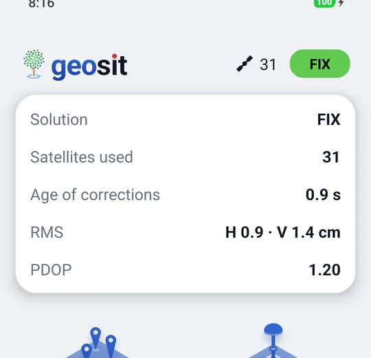
A tap on the number of satellites or on the solution pulls down the status panel; a second tap, or a tap outside, closes it. While it is open it updates live.
| Row | What it says |
|---|---|
| Solution | FIX, FLOAT, DGPS… as in the box |
| Satellites used | How many satellites go into the computation |
| Age of corrections | How many seconds ago the last correction arrived. Above 10-15 seconds the FIX is lost: that is why it turns orange from 5 seconds and red from 10. |
| Corrections | The mountpoint and the data received, when NTRIP corrections are turned on |
| RMS | The root mean square errors: the accuracy estimated by the receiver, horizontal (H) and vertical (V) |
| PDOP (or HDOP) | The geometry of the satellites: below 2 it is good, above 4 it is poor |
| Receiver battery | The charge, if the receiver reports it |
A tap on a row of the panel opens the receiver status, with the sky of the satellites and the signal chart.
Light and dark theme
geosit follows the phone's theme; in Settings you can set Light or Dark. In full sun the light theme is easier to read.