Projects
A project gathers the points of a survey: a wood, a parcel, a day on a construction site. Each project has its own name, its own reference system, its own way of giving elevations and its own attributes. You always work on one open project at a time.
From the Home screen, Project opens the list.
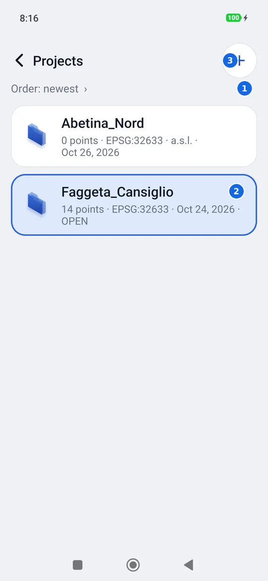
- Order: tap to choose how to sort the list.
- The open project, framed and labelled OPEN. Under the name: points, reference system (for example EPSG:32633), a.s.l. if the elevations are above sea level, creation date.
- +: new project.
Import and Export are in the menu of each project: press and hold the project (see below).
Opening a project
A tap on a project opens it and takes you back to the Home screen. The name of the open project appears under Project in the Home screen and, in the survey, in the capsule at the top: tapping it there takes you back to the list of projects.
Creating a project
The + at the top right (new project) asks for three things.
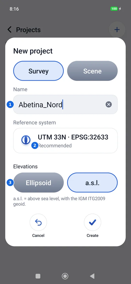
- The name. geosit suggests
Project_with today's date; you can write whatever you want. Two projects cannot have the same name. - Reference system of the grid coordinates: Recommended is the UTM WGS84 of the place where you are; you can choose another UTM zone or another EPSG system (see Reference system).
- Elevations: Ellipsoid (those of the GPS, by default) or a.s.l., above sea level with the IGM ITG2009 geoid.
Create opens the new project straight away.
With the Scene package (and during the trial days) at the top of the window there is also the choice between Survey and Scene: a scene is the survey of a road accident, with report number and location. See Scene: road accidents.
Which system?
In Italy UTM WGS84 has three zones: 32 covers the west (up to 12° of east longitude, EPSG:32632), 33 the centre and the east (EPSG:32633), 34 the Salento (EPSG:32634). You choose the system in which the office wants the coordinates, RDN2008 or Gauss-Boaga too: the whole project, exports included, will use it. The geographic coordinates (latitude and longitude) always remain saved, so no point is lost.
Ellipsoidal or a.s.l.?
The receiver measures ellipsoidal heights (on the WGS84 ellipsoid). In Italy they are about 40-50 metres higher than the elevations above sea level, those of the maps. With a.s.l. geosit applies the ITG2009 geoid and shows and writes the elevations as on the maps. Outside the geoid grid (on the open sea, outside Italy) there is no a.s.l. elevation, and geosit says so instead of giving a wrong number.
Pressing and holding a project
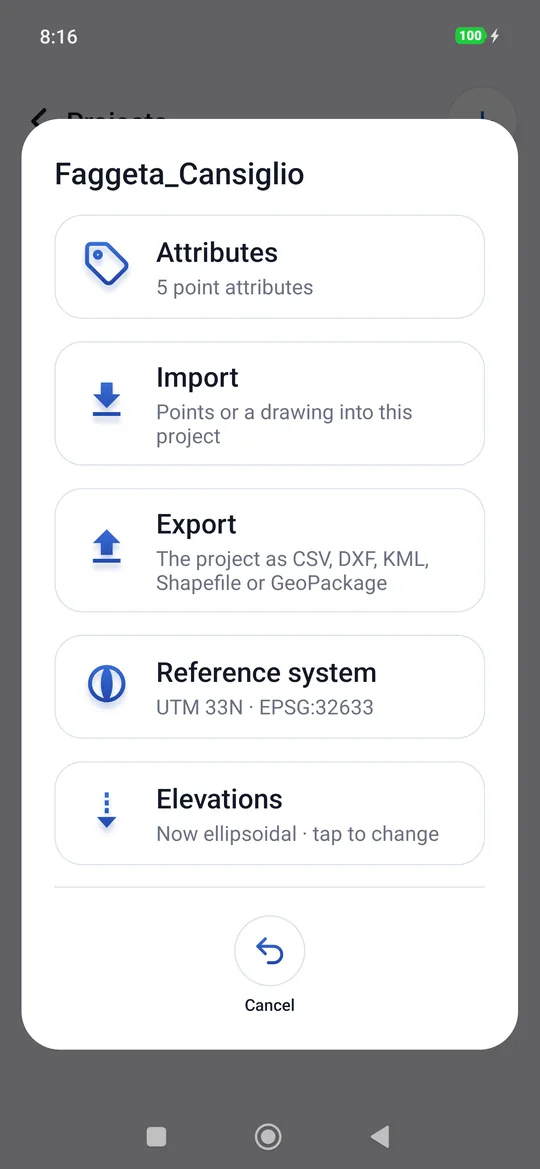
A long press on a project opens its commands.
| Command | What it does |
|---|---|
| Attributes | Opens the point attributes of that project: how many there are, or None · tap to create them. Only with the GIS package. |
| Import | Brings points from a CSV file or a DXF drawing into that project; a .mbtiles file becomes an offline map. |
| Export | The project as CSV, DXF, KML, Shapefile, GeoPackage or its raw data files. |
| Reference system | Changes the system of the project's grid coordinates (see Reference system). |
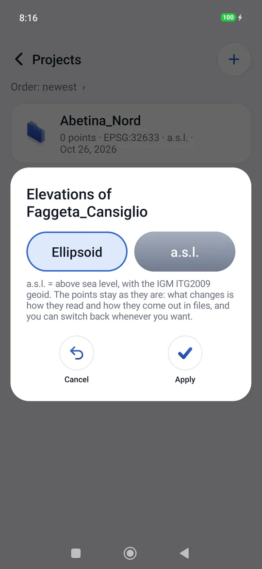
| Elevations | Switches from ellipsoidal to a.s.l. and vice versa, with Apply. |
| Select | To choose several projects and delete them together: a tap adds or removes a project, All takes them all, Delete deletes them after a confirmation, Cancel (or back) closes the selection. |
| Delete | Deletes the project, all its points and the raw data files, after a confirmation. There is no going back. |
Changing the elevations does not touch the points
Points are always saved with the ellipsoidal height. Changing Elevations only changes how the elevations read in the app and how they come out in files: you can change it as many times as you want, even when the project is finished.
Reference system
Each project has its own reference system, with its EPSG code: it says in which grid coordinates (Easting and Northing) geosit shows the points, exports them and reads imported ones. You choose it in New project:
- Recommended: the UTM WGS84 of the place where you are;
- UTM zones (WGS84): the 120 zones, north and south of the equator, always available, even without a network;
- Download all systems (about 1 MB): once only, with a network, it brings all the EPSG
systems in the world onto the phone. Then you search for them by code or name (for example
6707orRDN2008), and Valid here shows the ones that apply where you are, those of the phone's country first. While it downloads, the waiting window shows the percentage reached.
To change it later: press and hold the project → Reference system. The points stay where they are, because they are saved in latitude and longitude: the grid coordinates shown and exported change, including those of points already measured, and you can go back whenever you want. The project's DXF drawings also move to the new system, together with the georeferencing pairs: if a drawing falls outside the chosen system, the change is not made and the project stays as it was.
Projects created before version 1.0.6 have the UTM WGS84 of their zone: EPSG:32632, 32633 or 32634 (327xx south of the equator).
The order of the list
Tapping Order: … under the title you choose:
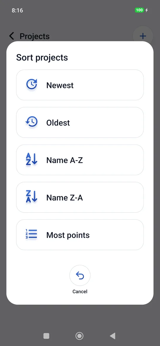
Newest (by default), Oldest, Name A-Z, Name Z-A, Most points. geosit remembers the choice.
Import and Export
They are explained on the page Import and export.