Settings and license
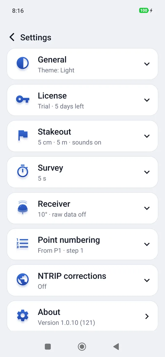
Settings in the Home screen opens the license and the preferences, divided into groups. Each group shows a summary under the title (5 cm · 5 m · sounds on); a tap opens it, another closes it. Choices among a few options, such as Language and Theme, open the same way under their row; once you pick one, they close again. The arrow at the top, ‹ Settings, goes back to the Home screen.
General
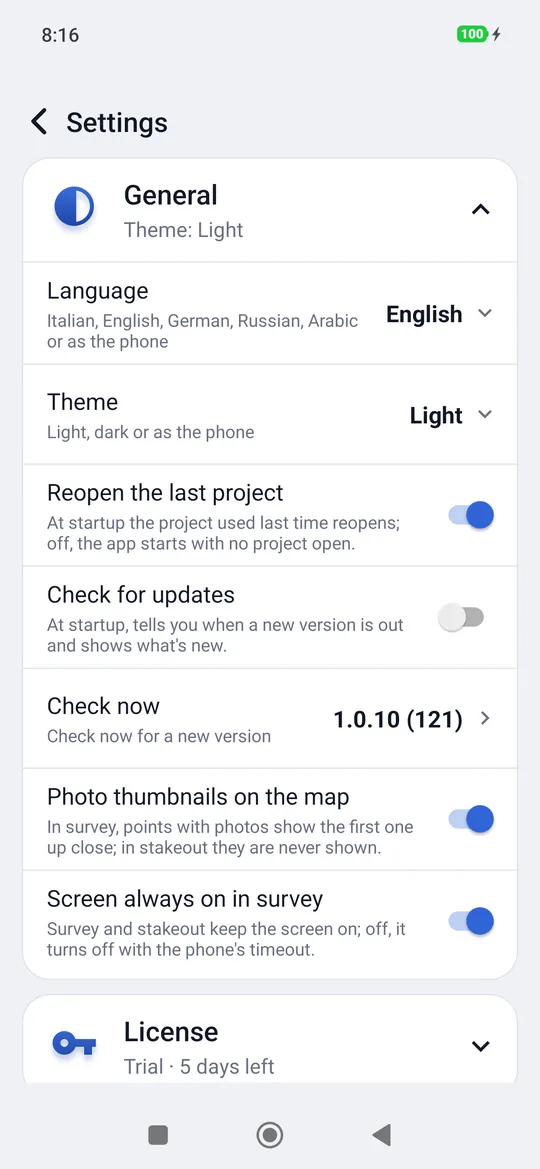
Theme: As the phone (by default), Light or Dark. The change is immediate, even while measuring.
Language: As the phone (by default), Italiano, English, Deutsch, Русский or العربية. In Arabic the screens read from right to left; coordinates and measurements stay in Latin digits, as on the instruments.
Reopen the last project: off (the default), geosit starts with no project open and you choose it in Project; on, it reopens the project used last time.
Check for updates: on (the default), at startup geosit checks whether a new version is in the store and, if so, offers it with the list of what's new: Update opens the store, Later postpones it (at most once a day for the same version). It needs internet; without it, nothing happens.
Check now: shows the installed version; tapping it, geosit checks right away whether a new version is in the store, even if the startup notice has already appeared or is off. If there is one, the same window with what's new opens; otherwise geosit is up to date appears.
After an update, What's new opens once at the first start, with the changes of the version just installed; it works without internet too, and it does not appear on a first installation. With the Don't show again box ticked it no longer opens, not even with later versions.
Photo thumbnails on the map: on (the default), in survey points with photos show the first one as a thumbnail when the map is close; off, the map shows only the points. In stakeout thumbnails are never shown, so they do not cover your position and the target.
Screen always on in survey: on (the default), survey and stakeout keep the screen on; off, the screen turns off with the phone's timeout, except during a measurement, the automatic point and raw data recording.
License
The first row tells the status of the license: Demo: connect an MS2 for the trial, Trial · 4 days left, Active · holder · until …, or Trial ended: enter the code (or Expired / Revoked: enter the code). Tapping it opens the row downwards, like the others, with the license details and its commands.
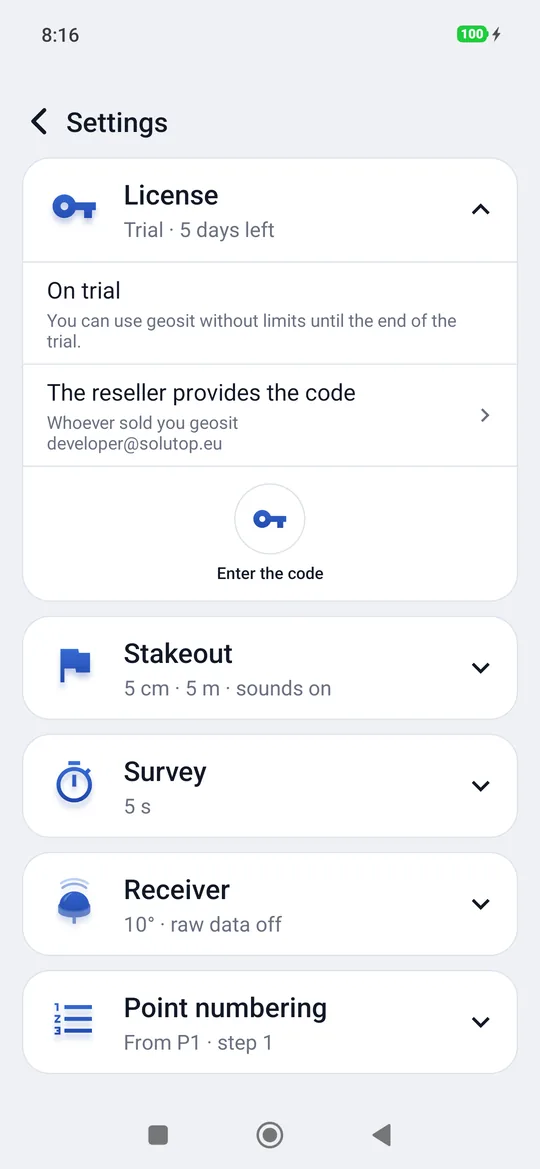
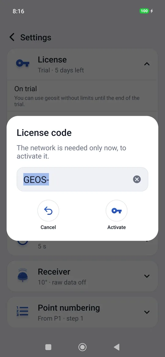
In Demo mode, before the trial starts, the row shows Demo mode: With the demo receiver you can try every feature. Connect your MS2 to start the 5-day trial. The trial starts with the first MS2 connected, after the window Start the trial? (see The trial and the license).
Activating the license
- Connect the phone to the Internet (afterwards once every 90 days is enough, or never again with a perpetual license: see below).
- Settings → License → Enter the code.
- Write the code the reseller gave you, in the form
GEOS-XXXX-XXXX-XXXX, and tap Activate.GEOS-is already written and geosit adds the dashes: just type the twelve letters and digits one after the other.
With the license active the row shows Holder, Expiry, Instruments (the receivers allowed, or Any receiver, or The first MS2 that connects until one is bound), Packages (Base, or for example Base + GIS with the point attributes, Base + Scene with the accident survey, Base + Pro with the CAD drawings and snap; packages add up, as in Base + Pro + GIS) and Code, with two commands:
- Update reads the license again from the server (for example after a renewal);
- Transfer frees this phone's seat: then you enter the same code on the other one.
Online once every 90 days
The license works without a network, but the phone must reach the Internet at least once every 90 days: when a network is available geosit renews the license by itself, once a day, without asking anything. A phone that always stays offline shows a notice in the last seven days; after 90 days survey and stakeout stop until the phone connects, and the license comes back by itself. Perpetual licenses have no such limit: once activated, they work forever even without a network; the Internet is only needed to activate a new phone.
What happens without a license
When the trial ends (or the license expires) geosit keeps opening projects, showing the points and exporting them, but no longer creates projects, imports, connects the demo receiver or opens the survey and the stakeout until you enter a valid code. The data already measured are always yours: they open and export even without a license.
| Message | What to do |
|---|---|
| This code does not exist | Check that you typed it correctly. |
| The code is already in use on all the phones allowed | Free a seat with Transfer from the phone that no longer uses it. |
| This license has expired / revoked | Contact the reseller. |
| No network, or the server is not responding | Try again with the connection. |
| Too many attempts from this network | Wait an hour and try again. |
Stakeout
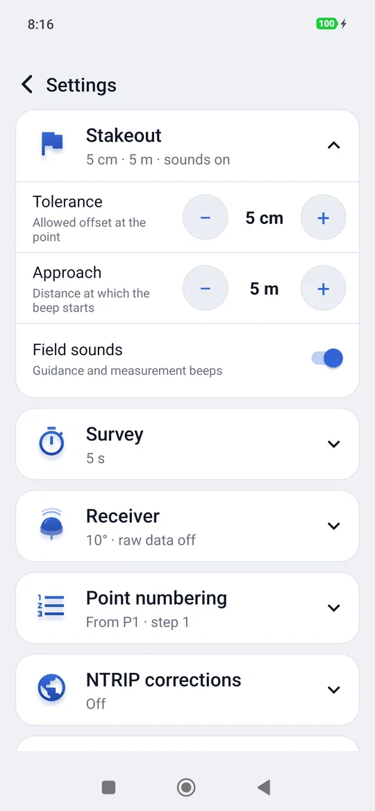
| Item | What it decides | Values |
|---|---|---|
| Tolerance | Within how far you are «on the point» | from 1 to 50 cm (5 cm by default) |
| Approach | From what distance the slow beep starts | from 1 to 50 m (5 m by default) |
| Field sounds | Guidance and measurement beeps | on / off |
The values are changed with − and +. See Stakeout.
Survey
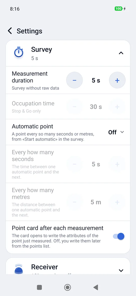
| Item | What it decides | Values |
|---|---|---|
| Measurement duration | How long to stay still on the point in a survey without raw data | from 1 s to 2 min (5 s by default) |
| Occupation time | How long each Stop & Go occupation lasts | from 5 s to 1 hour (30 s by default) |
How long to measure
With a good FIX 5 seconds are enough. Under canopy, where the FIX comes and goes, 10-15 seconds give a more stable average.
Automatic point: Off (the default), By time or By distance, with the value below. On, in the survey the big button becomes Start automatic (see Survey).
Point card after each measurement (GIS): on (the default) the card opens to write the attributes of the point just measured; off, you write them later from the points list.
Receiver
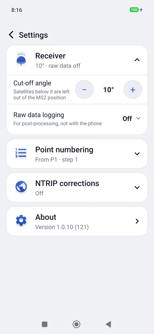
| Item | What it decides | Values |
|---|---|---|
| Cut-off angle | Lower satellites are left out of the position computed by the MS2, RTK included; geosit sends it to the receiver at every connection | from 0° to 30° (10° by default) |
| Raw data logging | Whether the survey also logs the raw data file, and how: see Static, kinematic and Stop & Go | Off / Static / Kinematic / Stop & Go |
Point numbering
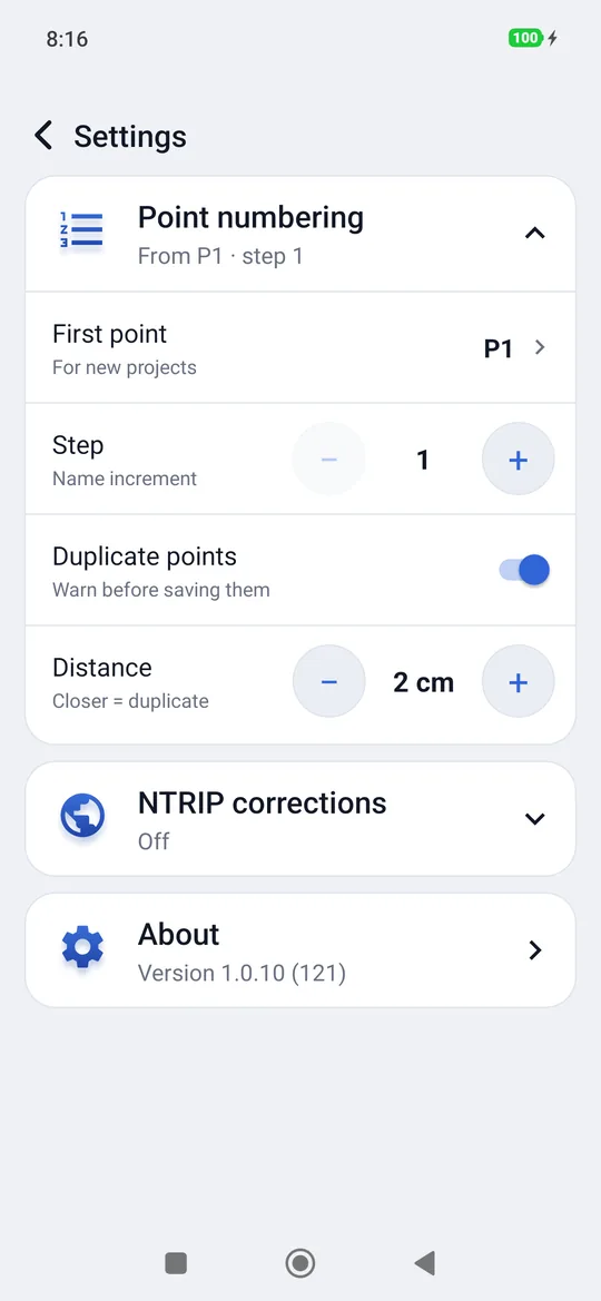
| Item | What it decides |
|---|---|
| First point | The name of the first point of every new project (P1 by default). It can also be just a number, for example 100. |
| Step | How much the name advances from one point to the next: 1, 2, 5, 10, 20, 50 or 100. With step 10, 100 → 110. |
| Duplicate points | On by default: before saving a point with the same name as another, or too close to an existing one, geosit asks. Off, it no longer asks; the point list still marks duplicates. |
| Distance | Below this distance two points are the same point: 1, 2, 5, 10, 20, 50 cm or 1 m (2 cm by default). |
The name of the next point of a project already started is changed from the name chip in the survey.
NTRIP corrections
The switch, the caster in use and the status of the corrections: everything is explained in Receiver and corrections.
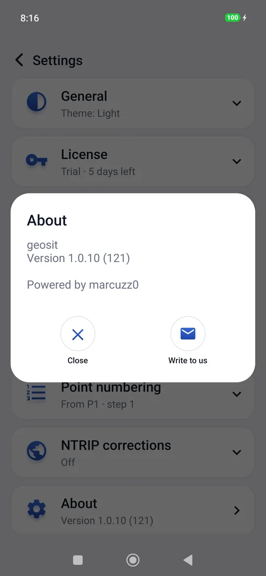
About
The last row tells the version of the app. Tapping it opens the About window;
Write to us prepares an email to developer@solutop.eu.