Static, kinematic and Stop & Go
Besides measuring points, geosit can log the receiver's raw data file: the satellite observations, to be post-processed in the office against a permanent station. This way you reach the centimetre even where there was no FIX in the field, for example under thick canopy or without network for the corrections.
A receiver is needed
The raw data file comes from the receiver. With the demo receiver there is none: even with static, kinematic or Stop & Go chosen in Settings, the survey stays a measurement of points and the Home says Point measurement.
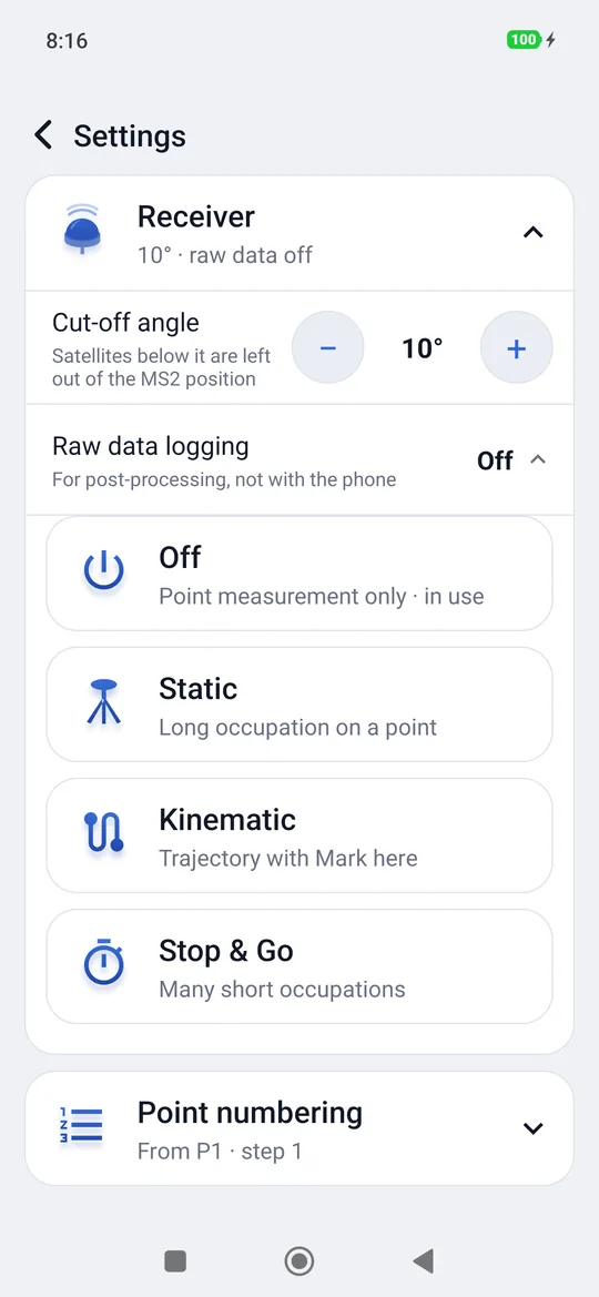
There are three ways of logging it, for three different jobs:
| Mode | When | What remains |
|---|---|---|
| Static | An important point, with a long occupation (minutes, even hours) | A raw data file for each point, with point name and pole |
| Kinematic | A trajectory: a trail, a boundary, routes on foot | A raw data file for the survey, the trajectory, and the points marked with Mark here |
| Stop & Go | Many points, with short occupations (30 seconds by default) | A raw data file for the survey and the occupation log |
Choosing it
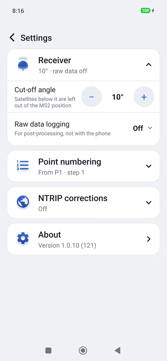
- Settings → Receiver → Raw data logging.
- Choose Static, Kinematic or Stop & Go (Off goes back to point measurement only).
- For Stop & Go also choose the Occupation time: how long to stay still on each point (30 seconds by default; from 5 seconds to one hour).
In the Home screen, under Survey, the chosen mode is written.
Connect the receiver first
If logging starts without a receiver connected, geosit warns: Raw data is not being logged. Without a raw data file the points cannot be post-processed.
Static
- Open Survey: the sheet says Static · one raw data file per point and the button is Start static.
- Put the pole on the point, levelled, and press Start static: the raw data file of that point begins.
- The sheet counts the elapsed time and says how many epochs and how many MB it has logged. There is no fixed duration: stay still as long as needed.
- Press Stop static: the file closes and the point goes into the project, with the average of the positions.
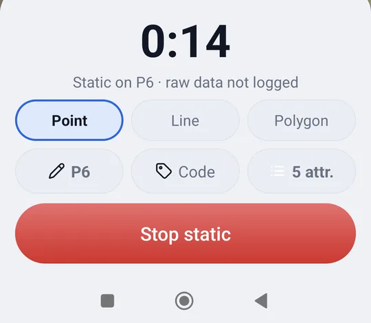
During the static the screen can even turn off or you can answer the phone: the raw data keeps going. If you leave the survey before Stop static, geosit asks (Static in progress): the point does not go into the project, but the raw data file logged so far remains.
Kinematic
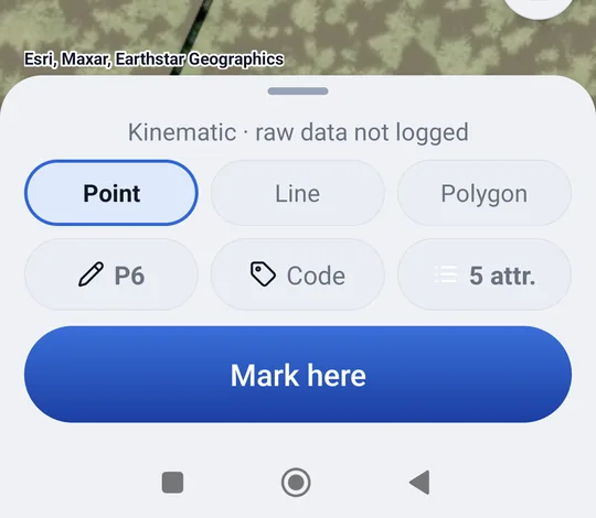
- Open Survey: the raw data file of the trajectory starts straight away, and the sheet says Kinematic · raw data 1.2 MB.
- Walk along the route with the pole upright.
- Where you want a point, press Mark here: the point goes into the project straight away, without stopping, and its instant is written to a separate file, to find it on the trajectory in the office.
If you change the pole
Kinematic has a single pole height per file: when you change it, geosit closes the file and starts a new one (Pole changed: kinematic continues in a new file).
Stop & Go
- Open Survey: the sheet says Stop & Go · raw data 1.2 MB · occupation 30 s and the button becomes Stop.
- Arrive on the point, pole levelled, and press Stop.
- Stay still while the countdown goes down (Hold still on point P9).
- When the time is up the point is saved (with the average of the positions, like a normal measurement) and the occupation is written in the log: you can set off towards the next point.
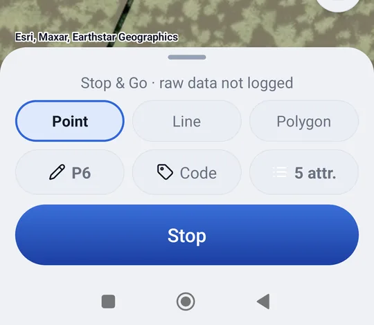
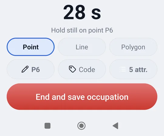
End and save occupation ends the occupation right away, without waiting for the time to run out, and saves the point with the epochs measured so far; in the log the occupation ends at that moment. Between one occupation and the next the raw data keeps logging: do not turn off the receiver and do not close the survey until the end of the round.
Closing the logging
When leaving the survey with kinematic or Stop & Go geosit asks Close raw data logging?: the files remain in the project. Stake out from a point also closes the logging, after asking.
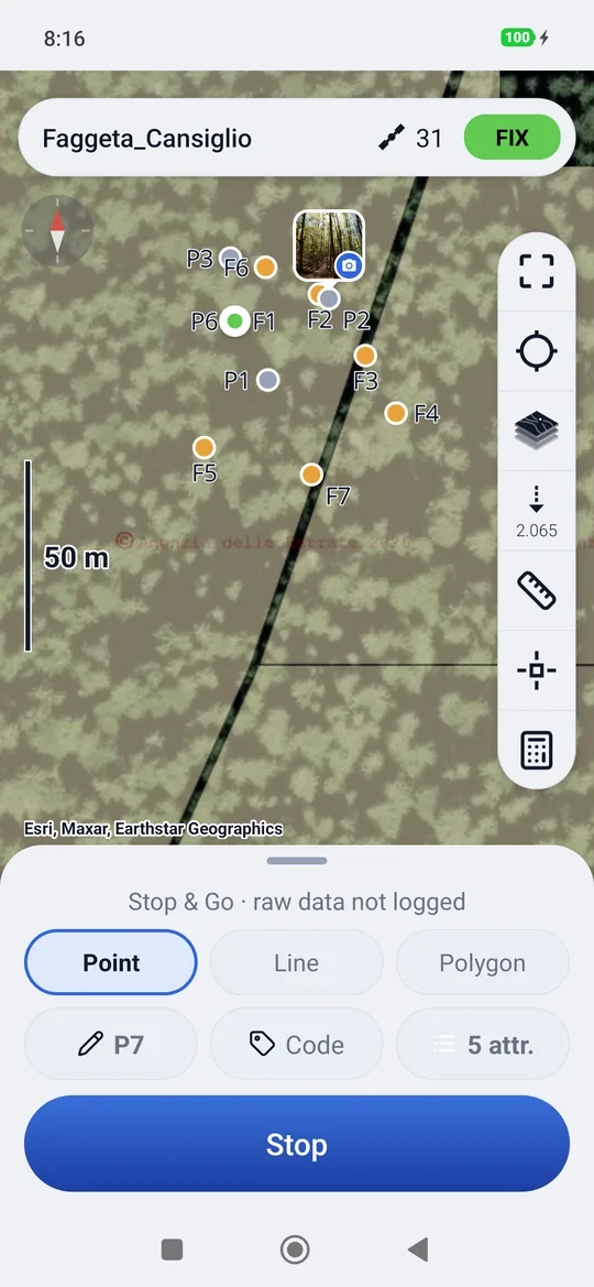
Every time you open the survey a new logging begins, with its own files. To go back to point measurement only, choose Off in Settings.
The files
The .ubx raw data file contains only the receiver's UBX messages: the NMEA sentences that
arrive alongside serve real time and do not end up in the file, so post-processing reads it clean.
The files have the name of the project, the date and time, and at the end the name of the point (static),
cinematico or stopgo. Next to each .ubx raw data file there is a .csv with the same name, already
in the format that post-processing requires:
| Mode | The .csv next to the raw data |
In addition |
|---|---|---|
| Static | Point name and pole height | — |
| Kinematic | Project name (the trajectory) and pole height | _segni.csv: the Mark here points, with instant, pole and code |
| Stop & Go | The occupation log, one Stop row and one Go row for each point | — |
In the .csv files the height is already that of the phase center: the pole plus the fixed 65 mm of the MS2 (2 m becomes 2.065).
The Stop & Go log has four columns:
| Column | Content |
|---|---|
Point |
Point name (letters, digits, _ - .: spaces become _) |
Timestamp(UTC) |
Receiver date and time, in UTC, with milliseconds: it is what cuts the raw data |
Action |
Stop or Go |
Height(m) |
Pole height |
They are sent to the office from Project → press and hold the project → Export → Raw data files: see Import and export.
A dying battery
Every row is written immediately: if the phone's battery runs out halfway through the day, the occupations and the points already done remain.